MLST-ASv2: MSG All-sky Land Surface Temperature, version 2
Demonstration Product ID: LSA-005.2 Version: 2.0 Published: 2026
Product Description
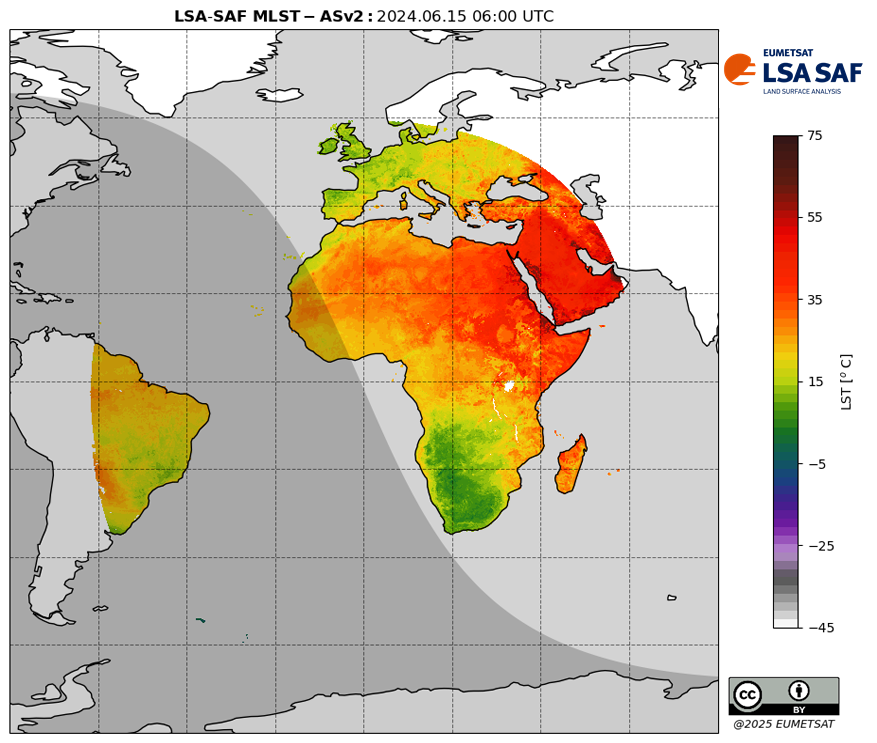
Land Surface Temperature (LST) is the radiative skin temperature over land. LST plays an important role in the physics of land surface as it is involved in the processes of energy and water exchange with the atmosphere. The MLST-ASv2 product combines clear-sky LST retrievals provided by the MLSTv2 product with cloudy-sky estimates generated by a energy balance model (METv3), both based on SEVIRI/MSG observations. Cloud information is obtained from the NWC SAF.
This product is currently under review and is available only as Demonstration.
Product Details
| Acronym | MLST-ASv2 |
|---|---|
| Spatial Resolution | 0.05º x 0.05º |
| Spatial Coverage | 80ºS to 80ºN, 80ºE to 80ºW |
| Projection | Regular lat-lon |
| Temporal Resolution | 30 minutes |
| Temporal Coverage Climate Data Record Near-Real Time | 21-Jun-2004 to 31-Dec-2024 1-Jan-2024 to present |
| Timeliness | 3 hours |
| Satellite | Meteosat-8 to -11 (MSG1 to 4) |
| Sensor | SEVIRI |
| Processing level | L4C |
| Format | NetCDF4 |
| Developer | IPMA |
Citation & License
| Licence | CC BY 4.0 by EUMETSAT |
|---|---|
| Citation | EUMETSAT LSA SAF (2026): MSG All-sky Land Surface Temperature, version 2. EUMETSAT. (date accessed) |
| Attribution | Attribution instructions are available here |
References
| Ermida, S. L., Dutra, E., Lopes, F. M., Gomes, S., Göttsche, F.-M., and Trigo, I. F.: LSA SAF Land Surface Temperature: Evolution and Validation of Version 2 suite of Products, Earth Syst. Sci. Data Discuss. [preprint], https://doi.org/10.5194/essd-2026-468, in review, 2026. |
History
| 2026/06/17 | Dataset was reprocessed to use MLSTv2. Previous version used the clear-sky MLST. |
|---|---|
| 2021/01/01 | Data release as Demonstration |